
:::


Jurisdiction
![]() Name Origin
Name Origin
Taiping City was originally called “Niarongtou”. 160 years ago, Lin Zhifang and his family, a branch of the Wufeng Lins, came to Taiping. They cut into the mountains and made tunnels, channeling water from Toubiankeng for cultivation, so that a wasteland became a fertile field. As there were two enormous Niarong trees in front of the the Lins’ mason, the villagers came to call the Lins in Taiping as “Niaotourong”. And because Lin Relin, son of Lin Zhifang, liked to wear double musketries on his waist, and because “Niaorongtou” and “Niaotongtou” are pronounced in the same way, thus, “Niaorongtou” is the origin of this place name.
![]() History
History
In Ching Dynasty, the whole of central, eastern, southern and parts of western and northern present day Taichong, the whole of Taiping City and Dali City, and part of Wuri Township make up Lanxing Castle. Before 1895 (Ching Dynasty 21), Taiping belongs to Lanxing Castle of Taiwan County of the Taiwan Government. In the same year, after losing the Jiawu Battle, Taiwan was ceded to Japan; the following year, it was changed to Lanxing Castle under the Taichong office of Taichong County. In 1901 it was changed again to Lanxing Castle of Taichong Ting, in 1020, it was named Taiping Base under Datung District of Taichong State. In 1945, it became Taiping Township, Datung Area, Taichong County . In 1950, it was modified to again to Taiping Taownship, Taichong County. In 1996, it upgraded to Taiping City.
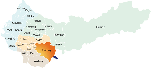
![]() Geographical Location
Geographical Location
Taiping City is situated in southern, a little to the west, Taichong County; on the east, it borders Quosxing Township, Taichung County and Dahengping straits, a branch strait of Snow Mountain; on the west and north, it neighbors Taichong City. With Han River, Dali River and Panzi River as dividers, Xingshe Township is to its northeast and Dali City and Wufong Township are to its southwest.
- Above sea level :Highest point: 1205m, on Dahengping mountain strait
- Population:169,000. Population density: 1400p/km2
- Education: Secondary school or below: 77.4%, high school or vocational school: 6.0%, College or above: 16.6%
- Area:120.7km2
- Festivals:Loquat Festival in March of every year
- Production:Loquat, longan, litchi, bamboo, carambola, honey
2014/10/14 10:41 AM
|
|
Copyright © 2010 Taiping Office of Taichung City | Best viewed with IE 8.0 or Firefox 15.0 with 1024x768 resolution. No.1-19, Dayuan Rd., Taiping Dist., Taichung City 41106, Taiwan (R.O.C.) Telephone number : +886-4-2393-3800 | On duty time: Monday through Friday: Am 8:00~12:00 Pm 13:00~17:00 |